Coastal cliffs · 9 min read
Eagle Gorge and Pot Alley
Two neighbouring coastal stops with different tempers — a lookout that sometimes becomes a beach, a steep road that hates vans, the Bigurda start, and a wind that does not care about your hat.
Editorial desk · Updated 2026-09-18
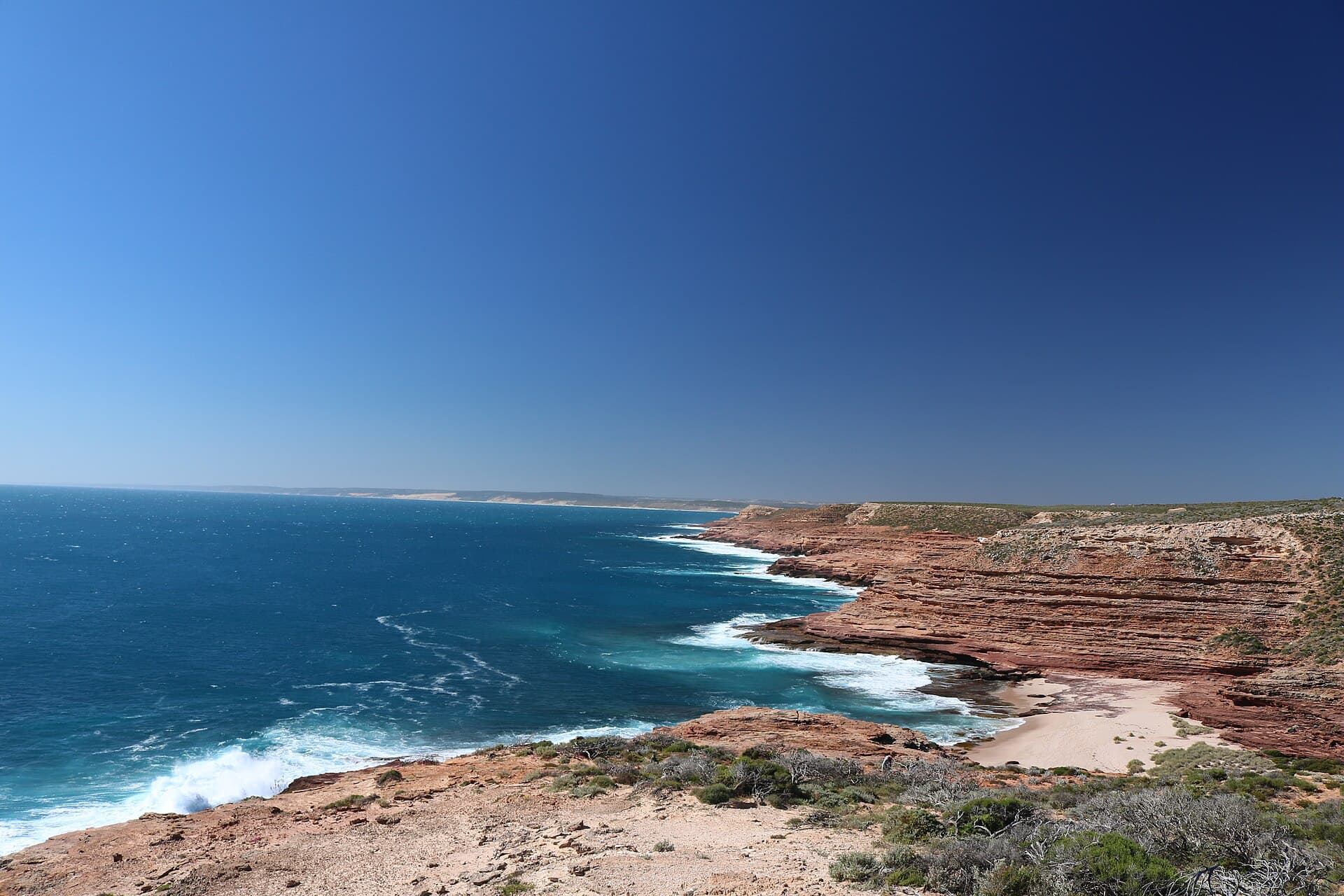
Photo: Warren Poole · CC BY-SA 4.0 · Wikimedia Commons. Source file · CC BY-SA 4.0

Warren Poole · CC BY-SA 4.0
Home / Visitor guides / Coastal cliffs
Eagle Gorge and Pot Alley sit close enough on the map that people treat them as one stop with two car parks. They are not. Eagle Gorge is the lookout — and, if you insist, a beach. Pot Alley is a steep little road that punishes long vehicles. Between them they mark the northern end of the Bigurda Trail. Wind runs the day more than distance does.
This is independent visitor writing, not a Parks and Wildlife brochure. Check Explore Parks WA and DBCA alerts the morning you go. The park is on Nanda Country. It covers about 186,000 hectares, about 590 kilometres north of Perth. Coastal lookouts south of town are generally free. Inland gorges are not — last-checked day rates were $17 a standard vehicle and $10 concession. Verify live fees before you mix the two halves of the map. No dogs, no park water, no casual camping. Western Shield 1080 baits are laid through this country.
How these two sit on the string
George Grey Drive is the spine. North of Eagle Gorge you have already passed Red Bluff, Mushroom Rock and Rainbow Valley. South you are heading for Island Rock and Natural Bridge. The coastal cliffs guide is the overview. This page is the messy middle: the place where people leave the lookout railing and start making extra decisions.
A two-wheel-drive hire car is enough. The road is sealed. Caravans can stay hitched for Eagle Gorge if the car park is calm. They should not follow you into Pot Alley. Town is the base. Lucky Bay camping is outside the national park. Hutt Lagoon is not in the park.
Give these stops the afternoon if you have already done Nature’s Window or the Skywalk. Give them a cooler morning if the coast is the whole day and you plan to walk Bigurda. The gorge and the cliff are the same park and not the same climate. Read best time to visit for the seasonal frame. The visitor guide will keep the fee split honest.
Eagle Gorge lookout — the visit most people should stop at
The lookout is the honest product. You park, you walk a short way, you look at a slice of coast that still feels like country rather than a viewing platform bolted to a postcard. On a clear day you can read the run of cliffs toward town. On a rough day you can read the swell without standing in it. That is a good deal for a generally free stop.
Stay on the formed path. The heath either side is not overflow parking for feet. In August to October the same heath may be carrying flowers that do not survive being used as a shortcut. Hold children at the lip. The drop is not theatrical until someone is too close to it.
This is also a wind site. If you are briefing a group about the beach track, do it in the car park. If someone is unsteady on their feet, the lookout is the whole outing. The stack further south will still be there.
Beach access — the caution that should live in the same paragraph
Some visitors go down to the sand at Eagle Gorge. Some of them have a quiet, careful hour. Some of them discover that the track is steeper on the way up, that the beach is smaller than the photograph, and that the water reaches further than the dry weed line. This journal will not tell you it is forbidden. It will tell you it is a different activity to the lookout, with a different risk.
Wave surge has killed people on this coast. A beach under cliffs is still a surge conversation. Pack the humility you would take to an unmarked west-coast gut, not the mood you take to a flagged suburban swim. If the swell is up, if you cannot see a sane line back, if children are already tired, stay up top. If you go down, do not turn your back on the water to compose a family line-up against the cliff.
There is no drinking water in the park. The climb back is the part people under-budget. Wear shoes you can climb in. Reception is not a plan.
Pot Alley — leave the van out of it
Pot Alley is a name with more charm than its road. The descent is steep and winding. Drivers of ordinary cars do it and come back with a story about first gear and patience. Drivers of long vehicles do it and come back with a story about paint, brakes or a three-point turn that should not have been required. Skip it if you are towing. Skip it if you are in a large motorhome. Skip it if you are already tired and the light is going. Eagle Gorge and Natural Bridge will give you the coastal day without that stub.
If you do drive it, do it slowly, in a vehicle that belongs on that grade. It is not a camping pocket. The same surge rule, no-dog rule and “generally free” sentence apply — no ticket booth, still a national park. There is no prize for completing every named bay on the tourist map.
Bigurda starts here
The Bigurda Trail is the cliff-top walk of the coastal park, about eight kilometres between Eagle Gorge and Natural Bridge. Eagle Gorge is the start for most people heading south. Natural Bridge is the finish they will remember if the wind has been kind. You can walk it the other way. You cannot walk it without water.
This is not a shaded river walk and it is not a gorge descent. It is exposed heath and cliff, with the ocean doing the talking. In a strong southerly it can feel longer than the sign. In flower season it can feel like the point of the week — and still you stay on the track. Side pads through the shrubs become eroded gutters by the next school holidays.
You do not need to walk Bigurda to visit either lookout. If you do walk it, read the Natural Bridge and Island Rock notes so the finish is a boardwalk, not a scramble to the waterline. Pair a shorter day with Red Bluff if the group has had enough wind.
Wind, whales and the rest of the honest kit
Wind is not a footnote here. It is the weather. Dress for it. If you are hanging onto a railing to stay upright, you are in a leaving stance. In season, people hope for whales; binoculars beat a climb toward the lip. Wildflower peak is August to October on the cliff-top heath — a reason to come, not a reason to leave the path.
Pack water, a layer, shoes, and a way to carry rubbish out. Fires are not a casual option. Pets are banned, including inside vehicles, because 1080 baits are not a rumour. The park phone is 08 9937 1140. We do not staff it. For fees, see the passes guide. For Country, Nanda Country. For the inland contrast, inland gorges and the geology if the red lower cliffs have started to look familiar.
Eagle Gorge is a lookout that will forgive a short visit. Pot Alley is a road that will not forgive a long vehicle. The beach will not forgive a swell you did not respect. Choose the version of the afternoon that brings everyone back to town.
Frequently asked questions
- Can you take a caravan down Pot Alley?
- You should not. Pot Alley is a steep, winding road. Leave caravans, long trailers and big motorhomes out of it. Use Eagle Gorge or the Island Rock car park instead. Coastal sites are generally free; the road is still a mechanical problem.
- Is the beach at Eagle Gorge a good swim?
- Treat it as a cautious access, not a patrolled bay. The track down can be steep and loose. The sand sits under cliffs in swell that can surge. Many visitors are happier staying at the lookout. Check conditions and official advice before you go down.
- Where does the Bigurda Trail start?
- The usual public telling is Eagle Gorge to Natural Bridge, about eight kilometres of cliff-top walking. Eagle Gorge is the northern trailhead most visitors use. Carry all your water. Confirm the track is open on Explore Parks WA and DBCA alerts.